Snow Peaks Detailed Course Description
DETAILED COURSE DESCRIPTION
NOTE: A lot of this description is written as if it were after a high snow year. Which can have up to 6 miles of snow on different parts of the course. In 2000 and 2001 there was literally only 30 to 40 steps which you ran through snow. So just be aware that from one year to the next the course can be very different.
START – to Mile 5.3 (Vivian Park to Aid Station #2, Hope Campground)
5196′ – 5110′ – 6660′ (-86′ drop, +1550′ climb)
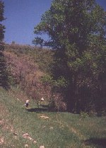
Race start at 5:00 AM following the Provo River Trail 2.1 miles down river past Bridal Veil Falls to the first aid station. (This begins your first climb which is actually a series of climbs that brings you to an overlook of Kyhv Peak and Rock Canyon.) Here you turn off the paved trail onto the new Bonneville Shoreline Trail. You will come to some telephone poles and then for a short distance onto an access road then the trail goes left off this road. Continuing the climb until you reach the Smith Ditch (This is an old water pipe road). Running along the Smith Ditch, for about a mile it temporarily ends, the trail turns left and takes you past a gate and then right onto a road and you cross a stream.. About 100 ft past the gate the course comes to an intersection of 3 roads, go left up the road it dead ends about a 1/4 mile later. At this point you cross an old creek and onto an old trail that was a logging road back at the turn of the 19th Century. This will take you a little over a mile up the canyon to Hope Campground and left onto a dirt road. At the top end of the campground you come to Aid Station 2 – 5.4 miles.
 Mile 5.4 to 7.6 (A.S. #2 to Squaw Peak road in Rock Canyon)
6660′ – 7820′ – 7300′ (+1160′ climb, -520′ drop)
You leave here following a trail, then a dirt road for a short distance and then up through a couple of meadows for about .75 of a mile. This brings you up to and across the Squaw Peak Road (dirt) and an overlook of Utah Valley. You continue up a ridge which then drops down into a small valley. Continuing the climb you soon reach the overlook of Squaw Peak about .7 miles. The course turns left and .25 miles later you are at the Rock Canyon pass on the Squaw Peak road (dirt ). You will cross over the road. The Trail goes down through a meadow off to the left side of the road. You will come onto the road about .6 mile later. Follow course markings.
Mile 7.6 to 14.8 (Squaw Peak road to A.S. #3 to Kolob Basin Overlook)
7300′ – 7040′ – 8480′ (-260′ drop, +1440′ climb)
Once on the road you will continue on (.8 miles) past the Rock Canyon Campground entrance (Mile 8.4) and you begin your second climb. You will come to the 3rd aid station somewhere between mile 9 and 11 depending how far up the road the snow has retreated and /or there are no avalanches blocking the road. The trail at about this point skips the switchbacks on the road and goes straight up the canyon, so follow the flagging. The next pass at “The Kolob Basin Overlook” the road after high snow years can be covered with snow. In many areas the snow should be off the edge of the road on the downhill side which is pretty good to run on. When you reach the pass and after low snow years this is where A.S. #4 is and you are at mile 14.8 and Horse Mtn. will be off to your right. Down in the Valley you will see Springville and Spanish Fork and in the distance to the south, Mt. Nebo .
Mile 14.8 to 22 (Kolob Basin Overlook to A.S. #5, Left Fork Hobble Creek)
8480′ – 5360′ (-3120′ drop)
About another mile after high snow years you should reach Aid station #4. It will be set up around mile 16 again depending on where the snow stops. About a mile later at 17 you go through Camel Pass and start down Pole Heaven Canyon.
 About 2 miles later you will cut down an old road to the right. after about a 1/2 mile it will cross the road again and after about another 200 yards it will come back out onto the road for 50 yards to a water station. The trail then cuts off to the right onto a hidden trail that will come back onto the road in about a 1/2 mile … so watch carefully for the course flagging and chalk on the road and trails. Once back on the dirt road, in a little over 2 miles miles you reach the gate at the Left Fork of Hobble Creek and aid station #5 (Mile 22).
Mile 22 to 29.6 (Left Fork Hobble Creek to Sheep Canyon, A.S. #7)
5360′ – 6540′ (+1180′ climb)
You now follow the paved road *watch for oncoming cars* heading NE for 3.7 miles up Left Fork and Aid Station #6 (Mile 25.7). Going right through the gate to the right, the road crosses (bridge) the stream and becomes dirt. About 1.4 miles up the road you come to your first good stream crossing. 2.5 miles further and another stream crossing you turn North (left) up Sheep Canyon. This is Aid Station #7 (Mile 29.6) with a unofficial cut-off time of 1:15pm. (That is 8 1/4 hrs to go less than 30 miles.) Rattlesnake Mountain is to your left.
 Mile 29.6 to 33 (just a 5K run, A.S. #7, Sheep Canyon to A.S. #8, Little Valley)
6540′ – 7620′ – 7120′ (+1080′ climb, -500″ drop)
The trail leaving 7 was an old 4X road. This is one of the prettiest parts of the course. It’s now just a trail that climbs 1000 ft. with a few more stream crossings and a few, sort of boggy areas in the next 2 miles. The trail goes up and over Wallsburg Ridge and into Little Valley. About .6 miles down from the ridge the trail comes onto a road another .6 miles you come to a fork in the road, follow the road to the left and this picks up the Great Western Trail at this point.
At this turn is Aid Station #8 (Mile 33) the Medical Check Station and cut-off point. If you don’t LEAVE this aid station by 2:30pm or you don’t pass the medical check, then you earn the right to a free ride to the finish.
Mile 33 to 40.4 (Little Valley, A.S. #8 to Windy Pass, A.S. #9)
7120′ – 8280′ – 7850′- 9300′ – 8932′ (ouch)
(+1160′ climb, -430′ drop, +1450′ climb, -368′ drop)
From here you begin your last 2 climbs heading west towards Windy Pass. The next 1.5 miles of road and then trail has several roads and trails that go off in different directions. So you have to watch the course markings very closely through this section there will be a couple more stream crossings. The last of which just after crossing the trail begins to climb out of the Canyon as it turns north and heads up to and crosses Wallsburg Ridge again. You will begin to hit some areas of snow again. The trail traverses around the North side of Bald Knoll for about a mile as it goes in and out of several little canyons along the traverse. and then heads south for a mile and drops in elev. So rest up. Your last and most difficult climb to Windy Pass, is just ahead. From Berryport Pass the trail turns west and climbs about 1300 ft. (7800′ to 9100′) in the next 1 1/4 miles. Again make sure to follow the course markings up the ridge. You will be going through tall foliage and snow. Just after the trail enters the first stand of tall trees the course leaves the trail and follows the ridge. A little over a mile up the ridge the trail will leave the ridge, through a small stand of Aspen Trees and starts to traverse up the south side of the mountain. Coming to a saddle between this and the next knoll the trail levels for about a 1/4 mile. It will then continue on a slight uphill traverse around the north side, about 1/8 mile through snow, crossing over a ridge and the highest part of the course at 9300 ft. you come through some aspen trees and more snow for about another 400 yards you will come back onto the ridge. About a 100 yards down the ridge you will be looking down on Windy Pass. This is aid station #9 (Mile 40.4) it has been limited the first 2 years because of its remote location. We are hoping this year to have a Llama to carry in more supplies. The water is provided by a spring just a couple 100 yards down the south side of Windy Pass.
Mile 40.4 to 50 (Windy Pass to Vivian Park and your finished!)
8932′ – 5196′ (-3736′ drop)
Taking the trail to the right, you begin your final descent of almost 4000 ft., heading North down Water Hollow canyon for .1 mile. This will be through snow, pines and aspens. The trail turns left and begins a 2 mile downhill traverse over to Shingle Mill Canyon. You will have snow, these are north and east facing slopes through more pines and aspens. It is this part of the course where the first 2 years we have had a couple of chutes that you cross that are pretty steep. There will be a guide rope at these locations if needed. The course follows the Shingle Mill trail for .3 miles and then follows a trail down along the left side of the canyon. 2.1 miles later the trail comes to a intersection of trails and roads. The trail cuts down to the right onto the Road and then past a gate, up over a small rise the road starts to turn to the right but straight ahead a trail cuts down to the left and a couple 100yards later comes back onto the road. Turn left and about a 1/4 mile later the road turns to right. Here again you leave the road to the left onto a trail that leads across a field towards a large barn. Through another gate and past the barn turning and back onto a road and about .3 miles later to the gate at the Big Springs Canyon Parking lot. Turn right onto the paved road and your at aid station #10 (Mile 46.3). 5800 ft. Then go for a .25 mile down the paved road and you turn left going down the South Fork Road *again be careful of cars* and the final 3.5 mile stretch down to the finish area at Vivian Park.