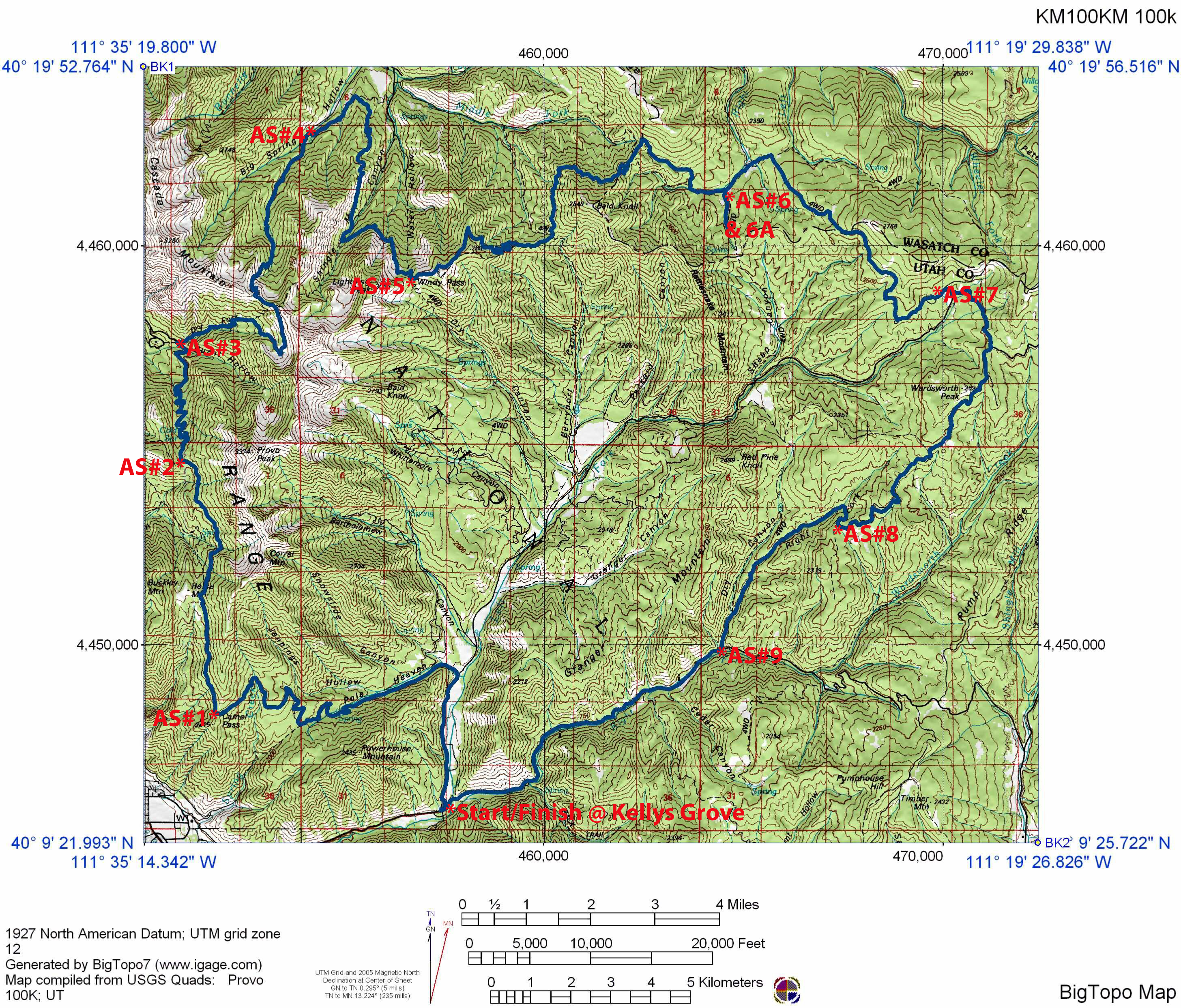
Kat’cina Mosa Course Map and Profile
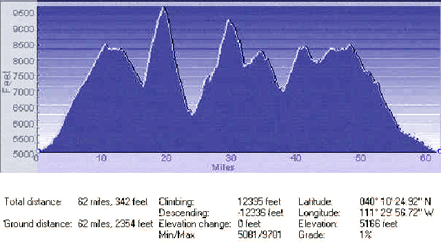
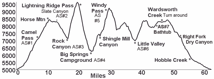
48% Trail, 44% Dirt Roads, 8% paved Roads, About 45% on the Squaw Peak Trail from about mile 2 to mile 16, and then about mile 24 – mile 37, going in the opposite or Clockwise direction. Start/Finish is shown on Map as Camp Jerimiah Johnson just past Rotary Park at the convergence of the Left Fork and Right Fork of Hobble Creek. Elev. Gain/Loss about about 16,000′
COURSE MAP(Click on map to enlarge)
COURSE ELEVATION