Snow Peaks Homepage
29th Annual
Snow Peaks 50 Mile Trail Run
formerly the Squaw Peak 50 Mile trail Run
The 2nd Sat in June … this means less snow (usually) on the course!
Sat. June 14, 2025 – 5:00 AM
Vivian Park, South Fork – Provo Canyon, Provo, UT

Powered By:

Vivian Park
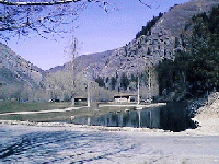
This is the start/ finish area at Vivian Park. This picture was taken in the afternoon looking east up the canyon. The park is located in Provo Canyon, 5.9 miles from the mouth of the canyon, which is the Junction of US 189 (University Ave.) and 800 North in Orem.
LOCATION
Vivian Park, Provo Canyon, Provo, UT. 5.9 miles up from the mouth of Provo Canyon. To get there from the North take the 800 N exit in Orem and head East to the mouth of the canyon about 4 miles. Coming from the South take the University exit, US 189. This takes you straight up to the Mouth of Provo Canyon, about 8 miles. Then proceed up the canyon.
HOST HOTEL: Hampton Inn & Suites
The hotel has a heated pool, Jacuzzi, banquet facilities and continental breakfast and is less than a 15 minute drive to Vivian Park. It is Located at 851 West 1250 South, Orem -across the street from Utah Valley University(UVU) and right next to the freeway. So, it is easy to find right off of exit 269 from I-15. We have been given a special rate/per room of $89 a night. To make a reservation call the hotel at (801) 426-8500. Dial “0” to get our local hotel. DO NOT DIAL “1” !!! You need to mention that you are with the Snow Peaks 50 Mile Trail Run.
PRE-RACE BRIEFING AND DINNER
Complimentary pasta dinner, Friday Night, June 13th from 5:00 to 7:30PM to all entrants, all others – $5.00 pre-paid when you register. $10.00 at the door. Pre-race briefing will begin at around 6:30 PM. I know these times might be early but I want to give everyone time to get home and get some sleep. The dinner and pre-race briefing will be at the Host Hotel – Hampton Inn & Suites, just south across the street from UVU. Please make every effort to be at the pre- race briefing. Saturday morning will not be the time for a lot of questions. Post race BBQ at Vivian Park. Entrants free, all others $5.
REGISTRATION PROCESS
Entries will be available online STARTING ON NOVEMBER 1st. capacity IS 350
Entry Discount for entering all 3 of the Mountain Oasis events. When Registering for Snow Peaks and you also enter for the Bigfoot Snowshoe Festival in January, and the Kat’cina Mosa 100K Mountain Run in August you get a $45 savings!!!
ROLLOVER Entries from this year, Check appropriate box to get discount.
If you rolled over in 2024 and also put in for a rollover from year 2023 — YOU ARE NOT ELIGIBLE! YOU PAY FULL PRICE
ENTRY FEES:
$170 – Nov 1st – Jan 31st,
$185 – Feb 1st – Mar 31st, $199 – Apr 1st – May 21st
Packet pickup will be at pasta dinner location.
To register go to the Ultra Signup link below:
WITHDRAWAL PROCEDURE:
If you wish to withdraw from the race. I need to have you send me an email dated on or before the 3rd Saturday before the race, stating your intentions to withdraw. Please include in subject line “Snow Peaks Withdrawal” There are NO REFUNDS but a portion of your entry fee will be rolled over for one year only … to next years race. This is not a guaranteed entry. Withdrawal must emailed. and you will need to re-register at the discounted rollover price starting Nov 1st for next years race. Any withdraws after that, the 3rd Sat before the race, are not accepted. Sorry no exceptions!
COURSE:
It is a very challenging, difficult and scenic loop course through the Wasatch Mountains above Provo, Utah. The trail will be marked (orange and blue flagging). It consists of – dirt trails (43%), dirt roads (38%) and some paved (19%). The paved sections are: The first 2.1 miles from the start at Vivian Park down the Provo River Trail down past the famous Bridal Veil Falls to the left turn onto the Bonneville Shoreline dirt trail . Then at the 22.7 mile mark, for 3.7 miles when you come out onto the left Hobble Creek Road, and the last 3.7 in South Fork Provo Canyon down to the finish back at Vivian Park.
There is over 13,000+/- ft. of elevation gain and loss, with 5 major climbs varying from 1100 ft to nearly 3000 ft. The first starts at mile 2.1. A series of climbs takes you up 2700 ft. over 5 miles to an overlook of Snoww Peaks. Check out the Trail Map and Course Elevation Profile page to see what the course looks like. The last and most difficult climb takes you from the top of Berryport Canyon, to the high point of the course just before and above Windy Pass at about 9300 ft. Depending upon which topographical map you look at there are two different trails in this section. On the 7.5 minute series (1:24000) the trail around peak x9297 goes around to the north. Both 30X60 minute series (1:100,000) maps I have used, show the trail going across the south face of peak x2834 (meters). The one on the south side is the trail we use on Race day by which time there should be little if any snow on this side, as you approach the high point of the course about a mile before Windy Pass. From here the course drops almost 4000 ft over the next 9+ miles back to the Finish at Vivian Park.
*NOTE*There can be sections of the course that are covered with snow. At about mile 11 after passing Rock Canyon, for about 2+ miles and then the section’s on and off approaching Windy Pass (‘9000) for about 4 miles and the next 2 after the pass. About a mile after coming off the pass there are a couple of areas where you cross the snow that are fairly steep and can be unnerving for some people. In ’99 we put up a rope across these 2 short sections to provide safety and security for those that needed it. And it paid off, even this years winner took a spill and the rope stopped his slide, which by the way, would be a shortcut. I told him afterwards “if he hadn’t have been flying across it he might not have slipped!” Anyway, those of us that are used to these conditions, as one women runner put it after the ’98 race, …”you runners that run up here all the time probably don’t even think twice about crossing stuff like that…” The figures given, of course, are approximate and will vary depending upon our winter. Our first 2 years were El Nino winters with a lot of snow. The ’99 run was a more normal snow year. The runners who had run in ’98 and then again in ’99, had a finishing time that was on an average over an hour faster. The 2000 race, the times again went down as there was literally only about 30 steps of snow up around the Windy Pass area. The snow was the same for the 2001 and 2002 races, with very little snow and new course records for both the men and women. IN 2004 there were only about 15 steps of snow but 2005 was a different beast with the most the course has ever seen with nearly 10 miles of the white stuff. And most of you know what happened IN 2011 with almost 25 miles of snow still on the course (looking somewhat similar to the picture below) and 2 roads washed out to 2 aid station I has to come with a alternate course. Which actually turned out to be a harder course that the original. Hopefully we won’t have to do that for another 15 years!!!!!
AERIAL PICTURE: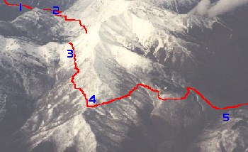
1. mile 7.7 2. Aid Station #3, mile 10.4 3. Aid Station #4, mile 16 4. Camel Pass, mile 17.2 5. Top of Pole Heaven Canyon, approx. mile 20
Possible Snow ConditionsPicture was taken May 7th, 1999. This gives you an idea of what the snow conditions can look like a month before the race. Generally there is NO snow from Aid station 4 (#3 on picture) on down the road going to AS#5 on race day. The 2000 and 2001 race there was no snow except way up in the higher elevations with very little on the trail.
FOREST ACCESS ROAD
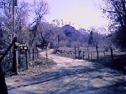
Looking southwest back towards Windy Pass from aid station 10. At this point you come back onto the pavement with only about 3.5 miles to go.
AID, CUT-OFF TIMES and DROP BAGS:
10 Aid Stations varying from about 3 to 7 miles apart. Water, replacement fluid, fruit, candy, pretzels, cookies, sandwiches, crackers, chips, potatoes, salt, etc. Medical at start finish and at mile 33, Little Valley aid station #8, There is also a 2:30 PM cut-off time at AS# 8. This is a safety cut-off to allow the back of the pack runners enough time to get up over the back country and most difficult part of the course before it gets dark at around 9:30 THERE IS NO FINAL CUT-OFF TIME
Drop bags (check in by 4:30am) and pacers allowed at Aid Stations 3 through 8 and 10. Crew access to most of the course. No access from mile 34 to 46 except by hiking or running.
COMMUNICATIONS:
Ham radio operators will be located at the Start/finish area and at aid station 3 (approx. mile 9-10.4, depending on snow), AS/4 (approx. mile 15-16, depending on snow), AS/5 (mile 22, Pole Heaven Gate), AS/6 (mile 25.7 North Fork Hobble Creek Gate), AS/7 (mile 29.6, mouth of Sheep Canyon), AS/8 & Medical Check Station (mile 33), AS/9 Windy Pass (mile 40.4) and at AS/10 (mile 46.4).
TEAMS: HUSBAND / WIFE DIVISION AND 4 PERSON TEAMS
For those of you who would like to make things a little more competitive, or just have some more fun, This will give an opportunity for more people to get awards. These awards will go to the to the teams with the best overall combined time. The 4 person team requires one person from the opposite sex.
AWARDS:
-
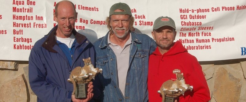
Hand made Navajo Indian sculpture’s to overall and 2nd in M/F open and masters
-
1st place awards to M/F in 10 year age group winners
-
Husband/Wife Team and Four Person Team – which must include one male or female. These “Awards” will be based on the best overall combined time
-
Long sleeve T-shirt for all participants and medal to all finishers.

