
3D Maps of Course
3D Maps of Course
These 3D maps were produced using Maptech Software
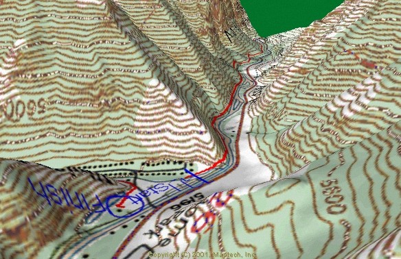
Bottom left AS#2 (mile 2.1) By Nunns Park to Squaw Peak overlook (mile 7)
Little bit different view from about mile 3 at bottom left up, looking up through Hope Campground to the Squaw Peak overlook
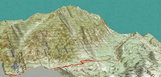
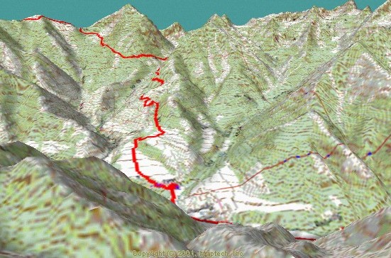
Squaw Peak overlook at bottom right, looking down into Rock Canyon and AS #3 in the Distance at about mile10 1/2
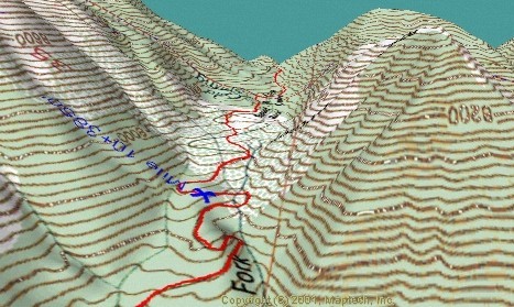
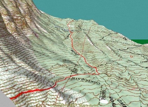
Mile 10 up through Rock Canyon AS#3 to about mile 12
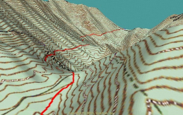
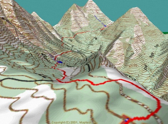
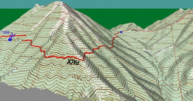
Traverse from 2nd Rt Fork Rock Canyon mile 11.5 to Horse Mtn AS#4, mile 14.5 in the distance
Horse Mtn AS#4, mile 14.5 down to Camel Pass mile 16.5
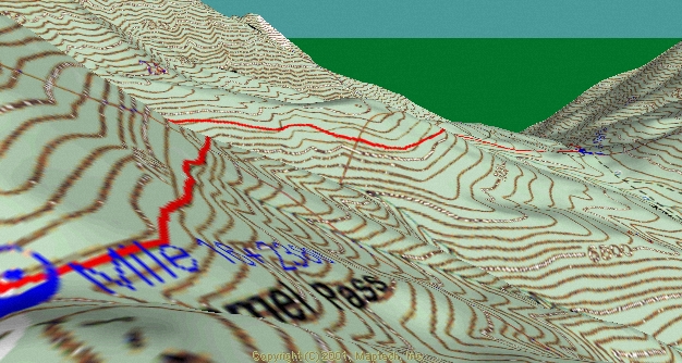
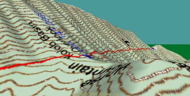
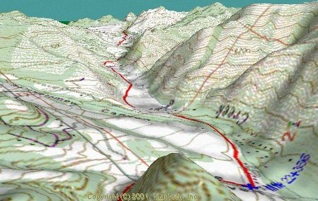
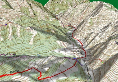
Camel Pass, mile 16.5 down to top of Pole Heaven Canyon and water stop at mile 19.2, An Easy downhill on dirt road. Just after coming out of 2nd canyon (that’s where the red line disappears the 2nd time) the course drops off the main road onto on old dirt road. So watch for flagging and markings on the road.
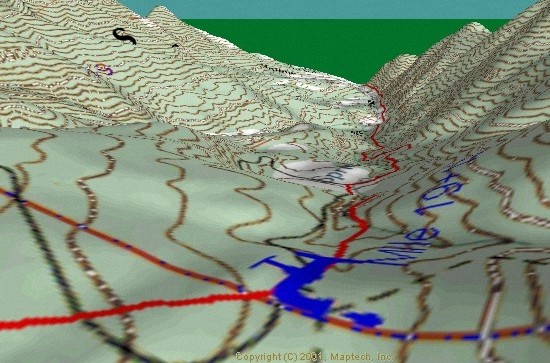
Looking Down Pole Heaven Canyon from mile 19 to mile to almost mile 22.
Looking east up Left fork Hobble creek from mile 22. The Pole Heaven AS transition
is from dirt road to paved road. It is 3.7 miles to Hobble Creek AS.
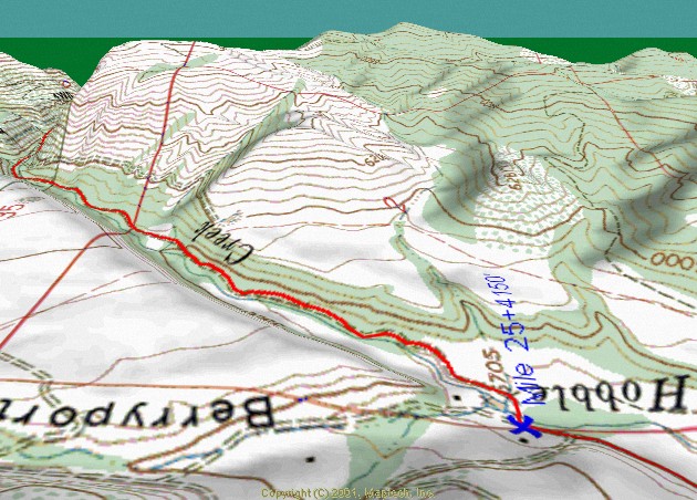
At the Hobble Creek AS you again go back on to dirt road
as you head up towards a section of the canyon called the narrows.
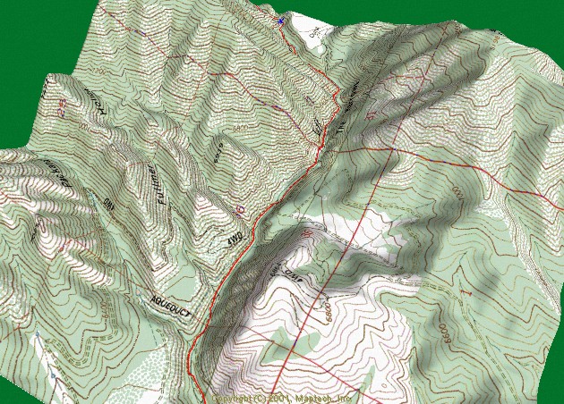
Looking down on the Narrows over about a 2 1/2 mile section as you
approach the Sheep Canyon AS at the top of the map.
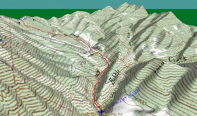
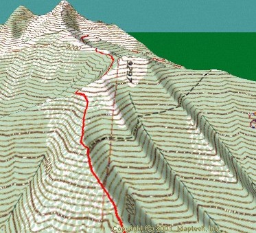
At the Sheep Canyon AS, mile 29.7 the trail heads
up through Sheep Canyon towards Wallsburg Ridge (top left)
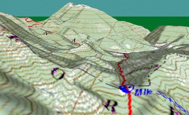
Looking north down into Little Valley and The Little Valley AS mile 33. There the trail
heads west up towards the 2nd crossing of Wallsburg Ridge (top left)
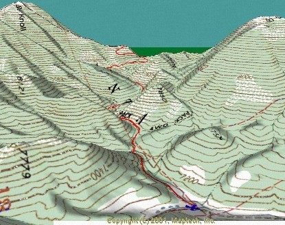
Looking west from Little Valley AS to Wallsburg Ridge
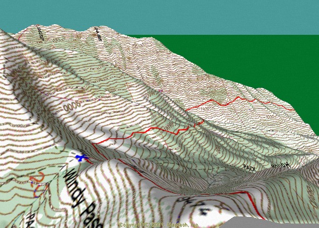
Mountain Lion Traverse …The “Ridge Climb” to Windy Pass in middle background(2nd red line)
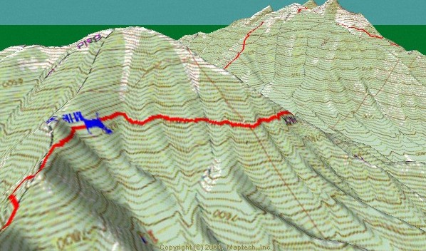
The trail heading East to West from Mtn Lion Traverse to the Ridge Climb before Windy Pass.
The Ridge Climb is the Hardest single mile of the course. In just a little over a mile you climb almost 1300′. It then levels to a very easy climb as you traverse below the 2 Peaks and reach the highest point of the course at just over 9300′ at the point where the trail goes over the ridge at top left middle of map.
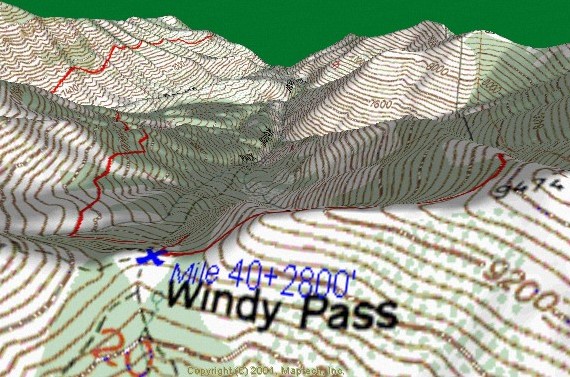
High point of course from where you descend down to the Windy Pass AS at mile 40.5. The view is spectacular when you are up here. NOTE: Locate the word “Windy“, Next to the “W” on the left side you can see a little circle indicating a spring. This is where we get our water for this remote AS.
Another view looking down from Windy Pass. The trail disappears around the corner into Shingle Mill Canyon. there is a slight climb before starting down the other side of the Canyon as you head towards Big Springs Canyon and Big Springs AS.
One more perspective looking back at Windy from just above The Big Springs AS #10.
The trail just before you get to the meadow and Big Springs AS,. Once you are back on the pavement it is 3.5 miles down South Fork Provo Canyon to the finish. This is where the Trail ends in middle of Canyon in top/middle of map.