Snow Peaks Homepage
Snow Peaks 50 Mile Trail Run — 2026
SNOW PEAKS 50
If it were easy, it wouldn’t be Snow Peaks 50
Registration
Registration opens December 31, 2025. Race capacity is 400. Register early — this race fills up.
Packet Pickup
Pick up your packet at either of the two pre-race locations, or race morning at the start line.
Pre-Race Guide
Review the full pre-race guide before race day. It includes key runner information, race-day logistics, course notes, aid station details, parking reminders, drop bag instructions, and other important updates.
You can view the raw PDF guide or watch the narrated pre-race guide with Race Director John Maack walking through the slides and key race-day details.
Course & Map
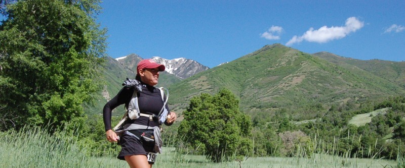
The Snow Peaks 50 mile run is held in Utah on the second Saturday in June. It is a very challenging, brutal and scenic loop through the Wasatch Mountains above Provo that will test your legs, lungs, and spirit. Technical terrain, big climbs, smooth and rocky descents, amazing views of the canyons and sprawling valleys below that stop you in your tracks. Runners will experience a mix of terrain: 43% Single track and dirt trails, 38% dirt roads, and 19% pavement.
PAVED SECTIONS INCLUDE:
- The first 2.1 miles from Vivian Park, following the Provo River Trail past Bridal Veil Falls to the turn onto the Bonneville Shoreline Trail.
- At mile 22.7, a 3.7-mile stretch along Hobble Creek Road before returning to dirt.
- The final 3.7 miles through South Fork Provo Canyon to the finish back at Vivian Park.
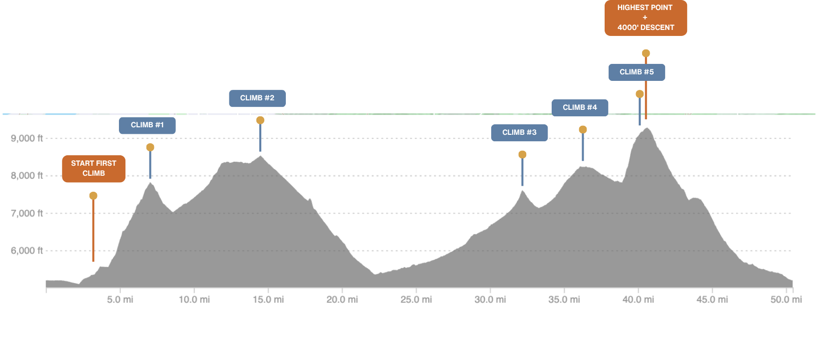
The course features approximately 10,000+ ft of elevation gain and loss, including five major climbs ranging from 1,100 ft to nearly 3,000 ft. The first climb begins at mile 2.1 and rises 2,700 ft over 5 miles to the Kyhv Peak overlook. The final and most demanding ascent takes runners from the top of Berryport Canyon to the highest point on course, just above Windy Pass at roughly 9,300 ft. Depending on conditions, runners may encounter snow as they approach this point—especially in late spring race years. From there, the route descends nearly 4,000 ft over the final 9+ miles back to the finish line at Vivian Park.
TRAIL MARKINGS
Orange flagging marks the way. Orange & blue flagging flagging together indicate critical turns and junctions — when you see both colors, prepare to turn. If you do not see flagging within 1/4 to 1/2 mile, check the course on your device to confirm you are still on course.
MAP & GPX:
Mandatory: You must have the course loaded on your phone or GPS device before the start.
**Our intent here is to have all participants running the course with their course on their phone and/or a GPS device. The full course will be marked however, over the years we have had wildlife and humans disturbing course markings. Having the track on you at all times can be an important peace of mind if you come to a spot on course where you’re unsure of where to go.
ELEVATION PROFILE:
To meet the mandatory course-tracking requirement, you can use this free tool to upload the GPX and follow your live location on race day:
Aid Station | Drop Bags | Cut-Off
9 aid stations spaced 4-7 miles apart. Medical support is available at the start/finish and at Little Valley (AS #7, mile 33).
Ham radio operators will be located at the Start/finish area and at all aid stations.
| Aid Station | Mile | Drop Bags | Crew |
|---|---|---|---|
| 1 · Hope Campground | 5.5 | — | — |
| 2 · Rock Canyon | 10.8 | — | — |
| 3 · Horse Mountain | 14.6 | yes | — |
| 4 · Pole Heaven | 20.9 | yes | — |
| 5 · Hobble Creek | 26.0 | yes | yes |
| 6 · Sheep Canyon | 29.9 | yes | — |
| 7 · Little Valley ⚠ | 33.5 | 2-gallon bag max | 4×4 only |
| 8 · Windy Pass | 41 | — | — |
| 9 · Big Springs | 46.5 | yes | yes |
3:00 PM cutoff at AS #7 (Little Valley) — safety cutoff to allow time to clear Windy Pass before dark.
Windy Pass – Liquid Only due to the aid station being remote, we’re only able to offer liquid only. Please have what you need coming out of Little Valley to get through to Big Springs.
Drop bags must be at the start line by 4:45 AM — label each bag with your bib # and aid station name.
Aid station items include: Water, RE-LYTE hydration mix & electrolyte caps, carb drink, fruit, candy, pretzels, sandwiches, chips, potatoes, salt, various sodas, and more.
Moving cup-less – we are moving toward a cup-less format. Please bring your own reusable cup, bottle, or hydration packs. Aid station cups will be limited.
Gear Requirements
Required
Recommended
DONT GET LOST
**We mark the course well, but deer, elk, and the occasional human have other ideas. Download the GPX and keep it on your phone or GPS watch — it’s your backup when a ribbon goes missing. Pay attention out there and you probably won’t need it, but it’s required and it matters. Watch users: bring a phone too.
Pacers & Crew
Pacers may meet runners anywhere along the 3.5-mile paved road between the end of the dirt road (KHYV Rd. / Old Squaw Peak Rd.) and Hobble Creek AS #5.
Crew allowed at AS #5 Hobble Creek (mile 26), AS #7 Little Valley (mile 33.5 — 4×4 high-clearance only, not recommended), and AS #9 Big Springs (mile 46.5).
No crew at AS 1–4, 6, or 8. Driving up the dirt road to AS#4 Pole Haven or AS #6 Sheep Canyon will result in disqualification. No crew access from mile 34 to 46 except by foot.
Lodging & Camping
Host Hotel — Hampton Inn & Suites
851 W 1250 S, Orem · Exit 269 off I-15 · ~15 min to Vivian Park
Heated pool, Jacuzzi, continental breakfast · Pre-race briefing & dinner held here
Nearby camping (15–20 min from Vivian Park):
Withdrawal Policy
To withdraw, email before May 24th with subject line: “Snow Peaks Withdrawal”. Credits valid for 1 year and require re-registration the following year.
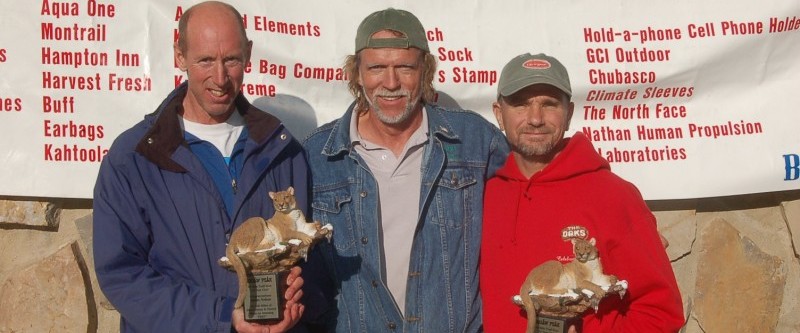
Awards
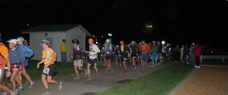
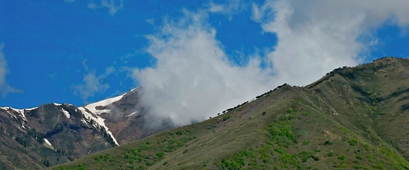
Possible Snow Conditions
Depending on the year, sections of the course may be snow-covered on race day. The photo below was taken May 7th, 1999 — about a month before race day — and gives a sense of what conditions can look like in a heavy snow year.
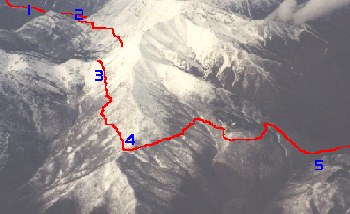
Waypoints in photo
- Mile 7.7
- Mile 10.8 — Aid Station #2
- Mile 16
- Mile 17.2 — Camel Pass
- Mile ~20 — Top of Pole Heaven Canyon
Generally there is no snow from Aid Station 4 down the road to AS #5 on race day. In 2000 and 2001 there was no snow except at the higher elevations with very little on the trail. In late spring years, expect snow around mile 11 after Rock Canyon for 2+ miles, and again approaching Windy Pass (9,000 ft) for about 4 miles and the 2 miles after the pass.
When snow conditions require it, the course may be modified. Any changes will be communicated to registered runners before race day.